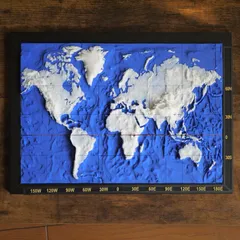
3D World Map
It is a 3D world map using a unique ratio height.
351
1994
6
12 k
updated February 18, 2024
Description
PDFThe production was based on the map data of the Geospatial Information Authority of Japan with my own unique adjustments.
Through adjustments I enhanced elevation height than actual data so that you can realize characteristic shape of ground form to understand geographical study.
The colorful model uses 13 different colors of filament!(3D_WorldMap_NoGL.stl & 3D_GreenLand.stl)
<Print Settings>
Top fill pattern:Concentric
Tags
Model origin
The author marked this model as their own original creation.


