Less Distorted 3D World Map

Description
PDFFeaturing: Real World Height Data
This map uses NASA's public topography data to show the shape of our world. The height is exaggerated, because otherwise you'll barely notice anything(Earth is pretty smooth overall, you see).
A World Map Less Distorted in Shape & Size
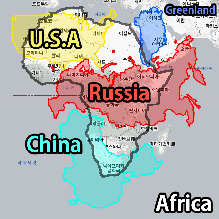
We've all seen the world map. Either be it the infamously inaccurate Mercator, or slightly better Equirectangular, they don't really give you the whole picture of the planet Earth. I mean, can you really imagine all the continents being a one giant Pangaea at some point just by looking at the world map? They all seem so…… separate!
Greenland isn't enormous. Africa is bigger than you'd think.
While a regular world map lets you easily tell the latitude and longitude of a place, it is horribly misleading when you're trying to learn the actual shape of the earth. (Comparison using True Size)
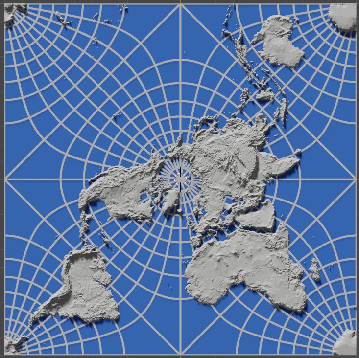
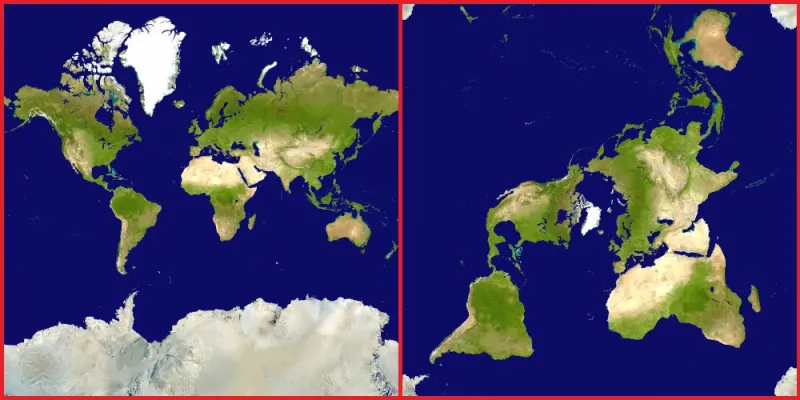
The World, As Seen From the North Pole
Below is a comparison between the Mercator Projection and the Peirce Quincunial Projection I've used for this model. Notice the size differences of Greenland, northern Russia, and Antartica.
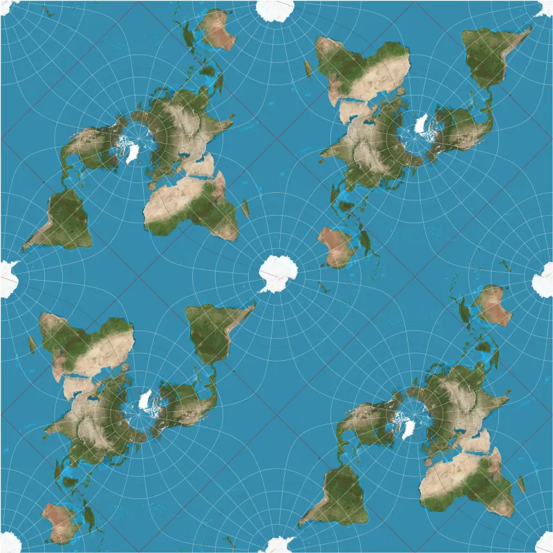
Infinitely Tile-able
The four corners of the map can tile together to form a view from the South Pole!
It isn't perfect (no map is, really)
Of course, even this Peirce Quincunial projection I've used isn't 100% accrate — lands closer to equator are slightly bigger (opposite problem of Mercator projection, though much less extreme).
There is no 2D map projection that displays every land 100% accurately. It is mathematically impossible
Print Settings
- For better accuracy, use variable layer height option to make land layers as thin as possible.
- For a faster print, set the layer height for the base plate(ocean) as thick as possible.
- The graticule lines(Latitude and Longitude) are set to be about 2 ~ 3 times the printing width. They might not slice well if you scale this model too small — enabling 'thin walls' would help.
- Use blue color for the ocean if you want better looking map.
Special Thanks
https://www.thetruesize.com/ for country size comparisons
NASA for Earth topography data
Justin Kunimune for his amazing software
Youtuber Sebastian Lague for sparking my interest in maps
Tags
Model origin
The author hasn't provided the model origin yet.